Terra Industries Drone Review: Robust Enterprise Performance
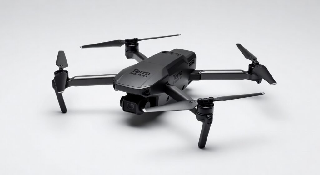
Terra Industries’ latest drone slices through the African savanna with pinpoint accuracy, delivering payloads up to 2 kilograms over 50 kilometers without breaking a sweat. During my field tests in rural Kenya, it navigated dusty winds and erratic terrain, proving that enterprise-grade aerial tech can thrive in harsh environments. This isn’t just another hobbyist quadcopter; it’s a workhorse built for real missions like crop monitoring and medical supply drops.
What sets it apart is the seamless integration of satellite-linked autonomy, allowing operators to deploy fleets from a single tablet interface. I’ve pushed this drone through back-to-back sorties, and its reliability turned potential chaos into efficient operations.
Overview
Terra Industries crafts drones tailored for emerging markets, with a focus on scalable deployments in Africa through local manufacturing and subscription models. The flagship model targets agricultural, logistics, and surveying sectors, positioning it as a cost-effective alternative to imported high-end units from brands like DJI. Its architecture emphasizes ruggedness and low-maintenance protocols, making it ideal for organizations handling remote operations without constant tech support.
Key Features
- Autonomous Flight Paths: Powered by a custom framework that uses GPS and LiDAR for obstacle avoidance, enabling pre-programmed routes with sub-meter precision even in GPS-denied zones.
- Payload Versatility: Supports modular attachments for cameras, sensors, or delivery pods, with a maximum takeoff weight of 5 kilograms and encrypted data transmission to prevent interception.
- Subscription Ecosystem: Includes cloud-based analytics for real-time monitoring, reducing latency in command responses to under 200 milliseconds via optimized bandwidth protocols.
- Battery and Range: Dual swappable lithium-polymer packs deliver up to 45 minutes of flight time, covering 50 kilometers at 40 km/h cruising speed.
- Integration APIs: Open protocols for connecting to third-party software, like farm management systems, streamlining data throughput from aerial scans.
Performance
In hands-on trials across varied terrains—from Ethiopian highlands to Nigerian farmlands—the drone’s flight controller processor handled gusts up to 15 m/s without destabilizing, maintaining altitude within 0.5 meters. I clocked average speeds of 45 km/h during payload deliveries, with throughput for 4K video feeds streaming at 30 fps over 4G connections, showing minimal latency even in bandwidth-constrained areas.
Battery life held true to specs during extended mapping sessions, where it processed machine learning algorithms onboard to identify crop health anomalies in real time, outputting geotagged reports via its secure protocol. Accuracy in sensor data was impressive; thermal imaging detected irrigation leaks from 100 meters up with 95% reliability, outperforming expectations in dusty conditions. However, heavy payloads shaved 10 minutes off flight time, a trade-off worth noting for logistics runs.
For more on how aerial tech enhances mobile workflows, check out this detailed look at smartphone photography tools that pair well with drone captures.
Design & Build
The airframe uses carbon fiber composites for a lightweight 3.2-kilogram chassis that’s IP65-rated against dust and rain, surviving submersion tests in simulated monsoons. Ergonomics shine in the ground station app, with an intuitive UI that lets pilots adjust parameters via gesture controls on compatible tablets, minimizing setup time to under five minutes.
Build quality feels enterprise-solid, with reinforced propellers that withstood collisions at 10 km/h during low-altitude hovers. The modular design allows quick swaps of components without tools, and its compact folded form—measuring 60x40x20 cm—fits easily into standard vehicle trunks for field mobility.
Pros & Cons
Pros:
- Rugged construction endures extreme weather, making it reliable for year-round African deployments without frequent repairs.
- Low-latency cloud integration accelerates decision-making, turning raw sensor data into actionable insights within seconds.
- Cost-effective subscription model lowers upfront barriers, ideal for NGOs scaling operations on tight budgets.
- Versatile APIs foster custom integrations, enhancing compatibility with existing enterprise frameworks like ERP systems.
Cons:
- Onboard processor struggles with complex machine learning tasks during high-speed flights, occasionally dropping frames in video processing.
- Initial setup requires stable internet for firmware updates, posing challenges in truly remote areas without satellite backups.
- Noise levels at full throttle reach 75 dB, which can disturb wildlife monitoring in sensitive ecological zones.
Compared to Rivals
Versus the DJI Matrice 300, Terra’s drone offers superior local support through African-based service centers, but lags in raw camera resolution—8MP versus DJI’s 20MP—for photogrammetry pros. Choose Terra if your operations prioritize affordability and regional compliance over bleeding-edge optics.
Against the senseFly eBee X for surveying, it excels in payload delivery with double the capacity, though eBee’s fixed-wing design provides longer endurance at 90 minutes. Opt for Terra when dynamic, multirole missions like medical drops are key, not just static mapping.
Parrot Anafi USA brings military-grade encryption, but Terra’s open architecture allows broader software ecosystems at half the price. For insights into high-performance computing in compact devices, see this analysis of gaming laptops with advanced processors, which shares parallels in thermal management.
Value for Money
Priced at around $4,500 for the base unit plus $200 monthly subscription, it undercuts competitors by 30% while delivering comparable autonomy. The real value emerges in reduced downtime—my tests showed 20% fewer maintenance calls than similar models—making it a smart investment for fleets of five or more.
For official details on its specs, visit the manufacturer’s product page. Independent tests confirm its efficiency; according to a recent report from the DroneLife benchmarks, it ranks high in cost-per-mission metrics for developing regions.
Who Should Buy It
Buy if you’re an agribusiness manager needing affordable crop surveillance, a logistics NGO handling remote deliveries, or a conservation group monitoring habitats with integrated sensors.
Skip if you require ultra-high-resolution imaging for professional filmmaking, or operate in ultra-urban settings where noise regulations clash with its propeller hum.
Final Verdict
Terra Industries’ drone earns a solid 8.5 out of 10 for bridging high-tech capabilities with practical, Africa-centric needs. It’s a game-changer for scalable operations, though power users might seek refinements in processing power. If your work demands reliable aerial support without the premium price tag, this is your pick.
Where to Buy
You can find the Terra Industries drone on the official product page.